|
There's a land where
the mountains are nameless
And the rivers all run, god knows where.
There are lives that are erring and aimless
And deaths that just hang by a hair.
There are hardships that nobody reckons
There are valleys unpeopled and still
There's a land, how it beckons and beckons
And I want to go back, and I will.
Robert W. Service

Alaska
Highway celebrated its first 60 Years
by
Jerry
W. Bird
 Imagine
you are a time traveler. The year
is
1942.
The month is February - and our whole world is
gripped by total war. For the moment, Axis forces
hold the initiative, and for weeks following the
Pearl Harbor disaster, every ship leaving North
America's Pacific ports is threatened. The
president's directive is clear: Furnish a supply
route to the network of northern airfields - an
overland route to supplement our air and sea lanes;
one secure from attack." Approval comes swiftly,
and the task begins, with end points set up by the
military at Dawson
Creek, BC.
and Big Delta,
Alaska.
Overnight,
the entire North mobilizes, as the rugged Trail of
'42 rivals the famous Trail of '98 in worldwide
focus. Those of us living in the Yukon at the time
felt suddenly in the forefront of the action. What
some called North America's greatest construction
project since the Panama Canal began as a marvel of
mobility at the time. U.S. Authorities combed the
entire coast, seeking available water
transportation, creating a patchwork flotilla of
yachts, cargo vessels, tugs fish boats and
barges. Imagine
you are a time traveler. The year
is
1942.
The month is February - and our whole world is
gripped by total war. For the moment, Axis forces
hold the initiative, and for weeks following the
Pearl Harbor disaster, every ship leaving North
America's Pacific ports is threatened. The
president's directive is clear: Furnish a supply
route to the network of northern airfields - an
overland route to supplement our air and sea lanes;
one secure from attack." Approval comes swiftly,
and the task begins, with end points set up by the
military at Dawson
Creek, BC.
and Big Delta,
Alaska.
Overnight,
the entire North mobilizes, as the rugged Trail of
'42 rivals the famous Trail of '98 in worldwide
focus. Those of us living in the Yukon at the time
felt suddenly in the forefront of the action. What
some called North America's greatest construction
project since the Panama Canal began as a marvel of
mobility at the time. U.S. Authorities combed the
entire coast, seeking available water
transportation, creating a patchwork flotilla of
yachts, cargo vessels, tugs fish boats and
barges.
This
story is from the opening of a half hour
commemorative video, written by Jerry W. Bird for
the Canadian Government as a salute to the Alaska
Highway's 50th Anniversary. See
photos taken during construction phase
 The
Alaska Highway was also a massive sea-bridge,
spanning the coastal fjords of the Inside Passage
to historic Skagway, then over the
White
Pass
by
narrow-gauge railway to Whitehorse on the Yukon
River, or up-coast to Valdez, Alaska, near
Anchorage. Inland,
a 500-mile connection existed via rail and dirt
road, from Edmonton to the staging point at Dawson
Creek, BC. Mere dots on the map soon became
feverish anthills of activity, as mountains of
supplies and acres of equipment were stockpiled
along the way. The fleet
of paddle wheelers that plied the Yukon since the
Gold Rush of the 1890s was pressed into service,
since there were no real roads connecting the
territory's main communities. The
Alaska Highway was also a massive sea-bridge,
spanning the coastal fjords of the Inside Passage
to historic Skagway, then over the
White
Pass
by
narrow-gauge railway to Whitehorse on the Yukon
River, or up-coast to Valdez, Alaska, near
Anchorage. Inland,
a 500-mile connection existed via rail and dirt
road, from Edmonton to the staging point at Dawson
Creek, BC. Mere dots on the map soon became
feverish anthills of activity, as mountains of
supplies and acres of equipment were stockpiled
along the way. The fleet
of paddle wheelers that plied the Yukon since the
Gold Rush of the 1890s was pressed into service,
since there were no real roads connecting the
territory's main communities.
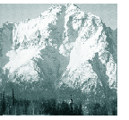
Brutal
Climate:
Reconnaissance, location work and a massive
construction effort began simultaneously. By float
plane, military aircraft, on foot, by pack horse,
cat-train or dog sled - they traversed hundreds of
miles in a few frantic months - up around, through
and over some of the world's toughest terrain. The
climate was brutal as anywhere on the globe. Elsdon
Gladwin, first Canadian Army officer to
drive the Pioneer Road described it to me.
"Those
U.S. troops - I felt sorry for them to begin with -
then was amazed at what they did. If you weren't
there, you just couldn't understand it. I saw
fellows so tired, they were ready to drop in their
tracks. It was rush-rush-rush! Fellows were doing
18 to 20 hours a day on bulldozers. One was up to
his neck in ice water repairing timbers in subzero
weather. God, I admired them! Most were southerners
- they'd never experienced cold like that. And in
the summer, it was mosquitoes - like they'd eat you
right there, or pack you away to eat at
home."
In spite of
muskeg, mountains and permafrost, the pace
continued unabated. It was a partnership between
army and civilian contractors of an unsurpassed
scale -leading to the final breakthrough at Beaver
Creek, near the Yukon-Alaska border. A formal
ceremony at Soldiers Summit by Kluane Lake marked
the event. The move by FDR earlier that year proved
to be more than an eleventh hour decision. By
December of '42, as convoys rolled up and down the
Pioneer Road, forces of the Japanese Empire were
already dug in on Alaska soil, preparing for the
assault we all expected.
The
preceding is from a half-hour documentary video,
"Alaska Highway - the First 50 year," written by
Editor Jerry W. Bird for the Alaska Highway's 50th
Anniversary. This historic event was celebrated
along the entire route, through British Columbia,
Yukon and Alaska. Thousands of veterans, both army
and civilian workers who participated in building
the "Trail of 42" plus others involved in upgrading
the highway to its present status, joined the
reunion.
This world
scale project helped create a vast air bridge to
Russian Siberia and the Orient - the foundation for
today's Air Highway to the Pacific as envisioned by
Grant MacConachie, and early bush pilot from
Edmonton, who later founded Canadian Pacific
Airlines. Many airport locations, such as Dawson
Creek , Fort St. John and Whitehorse were mere dots
on the map at the time. All of them are profiled in
Air Highways Magazine.As a guide to the area's
attractions, the Air Highways Supermap
traces
all routes by land, sea and air. This includes the
Overland and Marine Highways to Alaska, the
Cassiar, Klondike, Dempster and Mackenzie.
Connecting airline routes and ferry routes are also
included.
 P P
arYellowhead
Highway- Lake Manitoba to Haida Gwaii
PaColumbia
Valley Route-
East Kootenays to Jasper
....Sea
to Sky Highway-
to Whistler and beyond
|