
|
|
|
Airport
Info
. Tourism As
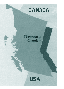
Mile Zero of the Alaska
Highway,
Dawson Creek serves as the transportation and
distribution center for the northeast corner of
British Columbia. Vital to that transportation
network is Dawson Creek's modern airport, featuring
a 5000 ft (1.524 m) paved runway, 5300 ft (1615 m)
Float Plane Base, restaurant, flight services
station and aviation fuel outlet - all just 7 km
from City
centre. *
The Alaska Highway 50th Anniversary Video has
appeared on local and world television, and is used
by cruiseship lines to inform and entertain
passengers en route to Alaska and the Yukon. A
brief
vignette
from that video is on this site. Dawson
Creek has commercial and light industrial property
for sale or lease. This creates an excellent
opportunity for a wide range of businesses, from
hotels to courier services, that would benefit from
locating near an airport, that is in turn very
close to the City. The City itself has relocated
its public works operation to the Airport in a new
12,000 square foot
facility.
Landing
surfaces include a 1,524 m asphalt airstrip and a
1615 m seaplane water strip. Passenger movements at
the Dawson Creek Airport in 1989 were 20,406 with
16,104 aircraft movements. By 1992 passenger
movements had increased to 34,407 and aircraft
movements to 22,4329. By 1996, passenger movements
were approaching 36,000 annually. The Canadian
north has long held the promise of riches and
adventure, a place where the lure of wealth and new
vistas prompted explorers to seek out new lands.
Today, that promise holds true, but modern
transportation links have made it fast and easy to
access these riches. Airport
history: As
early as 1930, the United States and Canada had
discussed the feasibility of building a first-ever
road from the contiguous United States via Canada
to Alaska. With the surprise attack at Pearl Harbor
on Dec. 7, 1941, and occupation of the Aleutian
Islands, the two countries were moved to action.
Construction of such a road was deemed necessary to
defend North America's Pacific Coast from attack.
At the time, Dawson Creek's licensed airstrip was
located in town limits, at the present location of
the Northern College campus. It began as a grass
strip, and was gradually improved to military
standards as the Alaska Highway took shape. Because
Dawson Creek was the "end of steel", it was here
where troops and equipment were dropped off, and
the massive construction project began. Hacked out
of raw wilderness under extreme conditions, the
2,500 km Highway was completed in just 8 months,
with official opening Nov. 20, 1942. This became
the first real land transportation artery in the
region and, other than air links, and the first
access through northeast BC to the Yukon and
Alaska. Black
Gold -- a rich resource Center
of a vast tourist area Local
attractions Connecting
Transportation mm |

 In
his history of the Alaska Highway for the Canadian
Government's 50th Anniversary
*Commemorative
Video, Air Highways editor Jerry W. Bird emphasized
how this single event transformed the entire
Canadian Northwest almost overnight. He was a child
at the time, living in the Yukon. One of the
communities most affected by this vast wartime
project was Dawson Creek,
BC.
In
his history of the Alaska Highway for the Canadian
Government's 50th Anniversary
*Commemorative
Video, Air Highways editor Jerry W. Bird emphasized
how this single event transformed the entire
Canadian Northwest almost overnight. He was a child
at the time, living in the Yukon. One of the
communities most affected by this vast wartime
project was Dawson Creek,
BC. 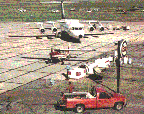 Dawson
Creek was the first city in Canada to privatize its
airport from Transport Canada ownership. The
airport features seven daily flights via Central
Mountain Air to Vancouver and Edmonton. The airport
also serves Peace Air. Canadian Helicopters also
has a base station in Dawson Creek. Northward Air
provides float and ski charters multiengine
Instrument flight Regulations and approved repair
and maintenance.
Dawson
Creek was the first city in Canada to privatize its
airport from Transport Canada ownership. The
airport features seven daily flights via Central
Mountain Air to Vancouver and Edmonton. The airport
also serves Peace Air. Canadian Helicopters also
has a base station in Dawson Creek. Northward Air
provides float and ski charters multiengine
Instrument flight Regulations and approved repair
and maintenance. n
n