
|
BE SEEN
IN Yellowhead |
|
Inland, a 500-mile connection existed via rail and dirt road, from Edmonton to the staging point at Dawson Creek, BC. Mere dots on the map soon became feverish anthills of activity, as mountains of supplies and acres of equipment were stockpiled along the way. The fleet of paddle wheelers that plied the Yukon since the Gold Rush of the 1890s was pressed into service, since there were no real roads connecting the territory's main communities.
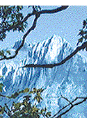
Brutal Climate: Reconnaissance, location work and a massive construction effort began simultaneously. By float plane, military aircraft, on foot, by pack horse, cat-train or dog sled - they traversed hundreds of miles in a few frantic months - up around, through and over some of the world's toughest terrain. The climate was brutal as anywhere on the globe. Elsdon Gladwin, first Canadian Army officer to drive the Pioneer Road described it to me. "Those U.S. troops - I felt sorry for them to begin with - then was amazed at what they did. If you weren't there, you just couldn't understand it. I saw fellows so tired, they were ready to drop in their tracks. It was rush-rush-rush! Fellows were doing 18 to 20 hours a day on bulldozers. One was up to his neck in ice water repairing timbers in subzero weather. God, I admired them! Most were southerners - they'd never experienced cold like that. And in the summer, it was mosquitoes - like they'd eat you right there, or pack you away to eat at home." In spite of muskeg, mountains and permafrost, the pace continued unabated. It was a partnership between army and civilian contractors of an unsurpassed scale -leading to the final breakthrough at Beaver Creek, near the Yukon-Alaska border. A formal ceremony at Soldiers Summit by Kluane Lake marked the event. The move by FDR earlier that year proved to be more than an eleventh hour decision. By December of '42, as convoys rolled up and down the Pioneer Road, forces of the Japanese Empire were already dug in on Alaska soil, preparing for the assault we all expected. The preceding is from a half-hour documentary video, "Alaska Highway - the First 50 year," written by Editor Jerry W. Bird for the Alaska Highway's 50th Anniversary. This historic event was celebrated along the entire route, through British Columbia, Yukon and Alaska. Thousands of veterans, both army and civilian workers who participated in building the "Trail of 42" plus others involved in upgrading the highway to its present status, joined the reunion. This
world scale project helped create a vast air bridge to
Russian Siberia and the Orient - the foundation for today's
Air Highway to the Pacific as envisioned by Grant
MacConachie, and early bush pilot from Edmonton, who later
founded Canadian Pacific Airlines. Many airport locations,
such as Dawson Creek , Fort St. John and Whitehorse were
mere dots on the map at the time. All of them are profiled
in Air Highways Magazine.As a guide to the area's
attractions, the Air Highways Supermap
traces
all routes by land, sea and air. This includes the Overland
and Marine Highways to Alaska, the Cassiar, Klondike,
Dempster and Mackenzie. Connecting airline routes and ferry
routes are also included. More
Great Journeys Back to (1) BC Scene (2) Air Highways (3) Africa Travel (4) Subscribe |
||||
 There's
a land where the mountains are nameless
There's
a land where the mountains are namelessRail
Adventures and
Super Cruises
and
Super Cruises
Details
.....